Contact address | Imprint | Deutsch
Cartographica Helvetica
Summary
Markus Oehrli
with the collaboration of Martin Rickenbacher
German war maps of Switzerland, 1939–1945:
a vademecum
The mapping activities of the German army during the Second World War did not only cover the theatres of war themselves but also neutral and non-belligerent countries. In this study, the German war maps of Switzerland published between 1939 and 1945 are fully documented for the first time. They are also set in the broader context of the war.
The first section highlights the different map series of Switzerland at that time. The Swiss 'Siegfried map' 1:25 000 and 1:50 000 as well as the 'Dufour map' 1:100 000 were used as a basis for the production of the German maps. On the German side, the Abteilung für Kriegskarten- und Vermessungswesen (Department for War Mapping and Surveying) of the general staff was responsible for the relevant activities of the army. Under its command, the Heeresplankammer (Army Map Agency) acted as the executive body. About a hundred private businesses were commissioned for map printing.
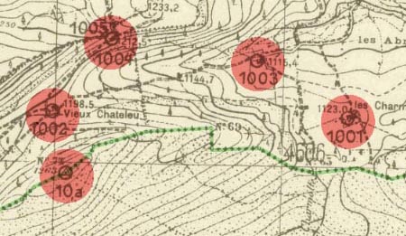
In the second section, the formal design of the German 1:25 000 war maps is described in detail. In the beginning, the German war maps were published under the code name Sonderausgabe (special edition). For the special edition of Switzerland, four sheets of the 'Siegfried map' 1:25,000 were mounted together in order to get one German sheet, to which a key was added. Later on, the design was further standardised. From 1942, the new editions were known under the generic name of Deutsche Heereskarte (German army map).
Map for the artillery (Library of Congress)
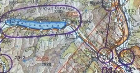
The chronological developments are dealt with in the third and largest section of this study. Five phases relating to the mapping of Switzerland can be distinguished. Even before the war, a general map 1:300 000 and a 1:100 000 map series (21 sheets) were produced. The year 1940 marks a peak in map production following the planned offensive against Switzerland that later became known as 'Operation Tannenbaum'. The planners called for the production of a 1:25,000 map series (171 sheets), the production of a road map, and for surveys of benchmarks along the Franco-Swiss border. A 1:100 000 fortification map series (19 sheets) was also printed. After a calmer phase in the middle of the war, strong Swiss-related activities unfolded at the end of the war. Thanks to files from the Heeresvermessungsstelle Wien (Vienna Army Surveying Office), one can understand exactly how knowledge of Swiss surveying matters was acquired in 1943 and 1944. The existing 1:25,000 map series was updated by using aerial images taken along the German-Swiss border, and expanded to cover the whole of Switzerland (254 sheets). The cartographic work was completed, but only 185 sheets are known to have been printed. After the surrender of the German forces, many German war maps were deposited with the archives of the Allies. In 1951/52 they were again brought to light in order to produce an Allied map series of Switzerland.
Map for the Air Force (Library of Congress)
A fourth, technical section presents details on German innovations in reproduction and printing technology. In mapping techniques, radical changes took place thanks to the 1936 invention of the Astralon foil. Standardised printing colours and paper sizes were further elements used to speed up map production.
The fifth section discusses some political aspects of the German war mapping and surveying programme. The German army planned a thorough standardisation of map projections, zero meridians, map grids, series of scales, sheet lines, and map keys. Ideas were taken from the 1:1 million International Map of the World and from captured Soviet maps, among others. However, in the final phase of the war the maps of Switzerland were only partially modified according to the new standards.
The results are then assessed within the framework of a general history of cartography. It should be emphasised that the German war maps of Switzerland were both up-to-date and complete in terms of coverage. With its nationwide scale standardisation the German Reich created a map image of Switzerland that had not existed before. Further research is needed in order to fully understand the worldwide German mapping and surveying activities during the Second World War. The comprehensive reference section may stimulate such research.
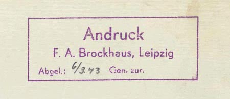
Map printing by the famous Brockhaus firm (Library of Congress)
In several appendices further material relating to the German war maps of Switzerland is presented. Firstly, the life and work of the head of the German war mapping and surveying programme, Lieutenant General Gerlach Hemmerich (1879–1969), is critically assessed. A topic hitherto not yet dealt with is the printing businesses that show up on the maps in coded form only; some of the most important businesses are subsequently unmasked (Updates here). In other appendices the German war maps of Switzerland are documented with map indices and detailed cartobibliographies. Lastly, a chronological table, a glossary, a list of abbreviations, and an index of names conclude this study.
Translation by Diccon Bewes
Price: CHF 48.– (to the order address).
© 1990–2026 Cartographica Helvetica (Imprint)